
Jackson Township Neighbors by Public Record
Public records can describe the land immediately around an address, the civic geography tied to it, and a limited historical trail. They do not establish a complete household list. A Jackson Township neighbor may be an adjacent parcel on a map, a property-record party, a nearby polling district, or a contact shown by a public community liaison. Those are different facts. Make the unit explicit before searching: a parcel, tax block, polling district, named community, street segment, or map view.
| Source | What It Shows About a Block | Access |
|---|---|---|
| Ocean County GIS | Parcel geometry, nearby parcels, mapped easements, rights-of-way, and planning or environmental layers | Public map; geometry is not a survey or social roster |
| County tax list | Municipality, block, lot, qualifier, location, class, and annual assessment context | Public parcel search; not title or occupancy proof |
| Clerk instruments | Recorded transfers, liens, easements, plats, and party roles tied to a parcel | SearchNG index with clerk copy and certification route |
| Election material | District boundary and polling-place geography | Official year-specific election pages; voter file is request-based |
| Civic liaison pages | Public community representatives and organization contacts | Township pages; no membership roster verified |
Ownership and occupancy are not the same. A tax account or recorded document may name a party with a mailing field or filing role. It cannot prove that person is a current neighbor. Utility customers, delivery recipients, unlisted occupants, protected voters, and other household members are not reliably exposed through these sources.
Jackson Township Parcel Map Layers
Ocean County's public GIS describes a map-based view of Jackson Township through cadastral parcels, municipal boundaries, imagery, zoning, flood areas, wetlands, streams, parks, preserved land, farmland, subdivision and site-plan layers, plus easements and rights-of-way. Each layer answers a spatial question. A parcel polygon shows mapped adjacency. An easement or right-of-way marks a mapped corridor. A zoning or flood layer supplies planning context. None replaces a survey, deed, or proof that two nearby people know one another.
The research did not document a Jackson-specific whole-street export, neighbor buffer, or radius roster in the live viewer. Use the map as a browse, pan, zoom, and parcel-selection tool, not as a promise that every surrounding record can be downloaded. If controls or a selectable polygon are unavailable, preserve the street and block-lot context and move to the tax search instead of guessing.
- Parcel
- A mapped piece of land associated with a tax or cadastral identifier. Its boundaries are not a legal survey.
- Situs address
- The physical location associated with land records. It can differ from a mailing address.
- Right-of-way
- A mapped corridor or access interest that may cross parcels without showing a personal relationship.
Note: Record the layer name and date because a map display may lag a recorded change or use a different update cycle from the tax list.
Map a Jackson Township Neighbor Block
The safe parcel-adjacency process is deliberately narrow. It begins with one address or map view, identifies the neighboring geographic feature, and then checks the record tied to that feature. It does not turn a visual neighbor into a household claim. The county hub may make surrounding parcels visible, but the research does not support a claim that it produces a complete people list or a verified radius tool.
- Search or pan to the address in the Ocean County GIS mapping hub and note the displayed parcel or street context.
- If the viewer permits selection, inspect the nearby parcel polygon and any layer that explains the shared edge, road, easement, subdivision, or public facility.
- Use the parcel's municipality, block, lot, qualifier, or property location in the county tax search to confirm the land record's identifier and year.
- Use the identifier or legal-description clue in the clerk's recorded-instrument index when the question is about a filing, not occupancy.
For a full named-street record chain, use the Jackson Township street directory. The block method stops at the immediate map and parcel context so it does not duplicate that broader address workflow.
Jackson Township Community Liaison Network
The Private Residential Advisory Board is a distinct Jackson Township resource. It is a bimonthly township forum with representatives from Four Seasons at Metedeconk, Four Seasons South Knolls, Meadowbrook Village, Westlake Golf and Country Club, and Winding Ways. That page establishes a public liaison structure and community labels. It does not establish who belongs to any community or who lives on a particular block.
Use the board when the goal is to find the public channel for a civic question, meeting purpose, or community-facing issue. A representative does not speak for every resident, and a named community on the page is not a verified address boundary. The research supports public contact routing, not reproduction of private rosters.
The Jackson liaison page identifies the public forum and its community context.
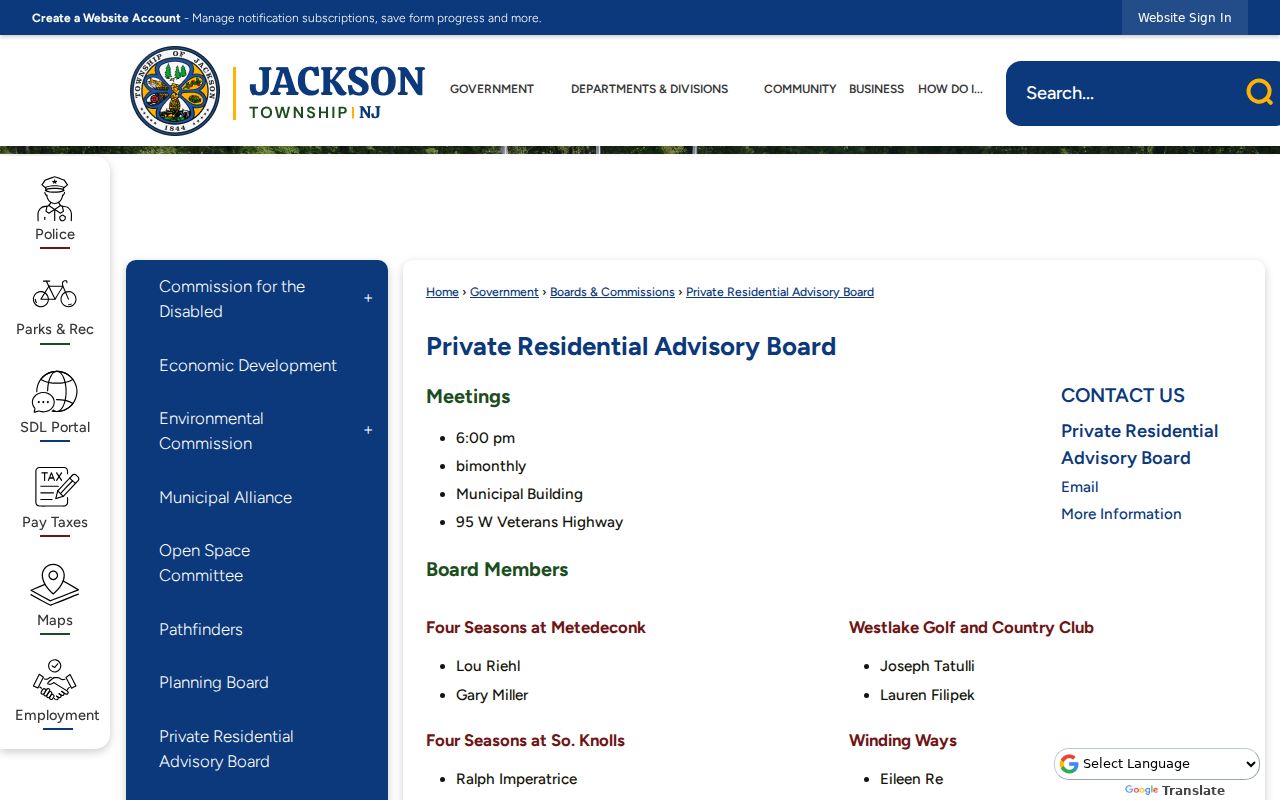
The board page adds a civic layer to a block search without converting parcel adjacency into personal membership information.
Jackson Township Civic Contact Routes
Jackson Township's public resource directory adds organization-level leads. The research identifies civic and veterans' organizations including American Legion, AMVETS, Disabled American Veterans, and VFW Post 4703. Those entries can help locate an organization's public contact route or local-history lead. They are not evidence that a person at a nearby address participates in an organization.
| Community or civic group | Public contact route | What the route establishes |
|---|---|---|
| Four Seasons at Metedeconk | Private Residential Advisory Board page | Public liaison structure only |
| Four Seasons South Knolls | Private Residential Advisory Board page | Public liaison structure only |
| Meadowbrook Village | Private Residential Advisory Board page | Public liaison structure only |
| Westlake Golf and Country Club | Private Residential Advisory Board page | Public liaison structure only |
| Winding Ways | Private Residential Advisory Board page | Public liaison structure only |
Open the Jackson Township civic directory to locate the published resource categories and organization entries.
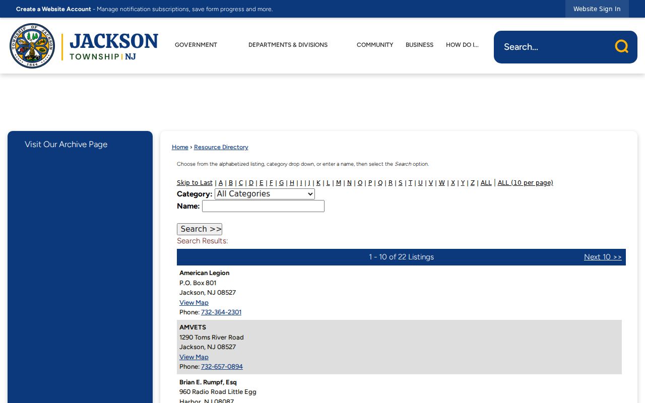
The civic directory is useful for public organizations and custodians, while a private member list was not verified in the source research.
Jackson Township Neighbor Election Geography
Jackson's official election material identifies 34 polling districts and named civic locations. A polling district is useful as a geography clue when a historical reference is vague, but it is not a roster of neighbors. Polling assignments can change, so retain the election year with any map or facility reference. Named facilities such as the Municipal Building, VFW Post 4703, Senior Center, fire stations, library, and community clubhouses identify public places, not attendees or residents.
The state voter status tool is for an individual verification and its live fields were not captured because the page returned 403 during research. A county voter-list request requires a signed OPRA form and must specify the desired geography, election or date, output format, and history criteria. New Jersey law protects addresses in some cases, excludes signatures, and bars solicitation uses. An old released file can also reflect a status that has since changed.
Jackson Township Neighbor Source Comparison
Official records and commercial neighbor tools answer different questions. The official route makes the keeper, field, date, access rule, and correction path visible. A commercial category may combine extracts and other data, but the research notes risks of stale information, merged names, incomplete coverage, paywalls, and difficult corrections. Treat a commercial result only as a lead that still needs a custodian check.
| Source type | Best use | Critical limit |
|---|---|---|
| Official GIS and tax records | Parcel and yearly assessment context | Not occupancy proof and not a legal survey |
| Clerk index | Recorded filing party, date, and legal-description trail | Party role does not prove a current neighbor |
| Election and civic pages | Lawful civic geography and public contact routes | No complete person or member roster |
| Commercial people-search category | Possible lead for a record to verify | Can be stale, mismerged, incomplete, or hard to correct |
For a significant property question, use the county clerk's copy or a qualified title process instead of relying on a map label or unsourced profile. The county's channels include online tax, GIS, and recorder tools, assessor questions, in-person clerk research in Toms River, mail, e-record options, and a focused OPRA request for maps, permits, or non-indexed municipal material. Keep the portal URL, result date, parcel key, and the question each source answered.
Jackson Township Neighbors Through Time
Historic block research uses a different stack. Jackson Township was created in 1844, and Ocean County was created in 1850 from Monmouth. An older reference can therefore sit in a different jurisdiction from the modern township. The State Archives, Ocean County Historical Society, Jackson Branch Library, newspapers, maps, deeds, tax material, and census collections each preserve different dates and formats.
Use a source's own date. A directory or newspaper can place a person or organization at an address for that publication date. A deed can show a recorded conveyance. A map can show a place or footprint. None alone recreates the present block. For a historical address, search name and street spelling variants, note the jurisdiction at the time, and distinguish an original page, scan, transcription, or compiled finding aid.
Note: No official source inspected for Jackson established a complete public historical block roster, so a gap should remain a gap.
Jackson Township Neighbors Privacy Limits
New Jersey access rules protect more than a map can show. The Address Confidentiality Program provides a substitute address for eligible participants, while Daniel's Law requires special treatment for covered officials and their immediate families. OPRA redactions can cover Social Security numbers, financial details, driver-license numbers, personal phone or email, parts of birth dates, victim or family information, and protected addresses. A public parcel layer does not override those protections.
Keep every question purpose-limited. Do not try to defeat a redaction by combining sources, request only the minimum needed record, and use the official custodian's correction path when an index is wrong. A deed party is not necessarily a current resident. A tax-list owner is not necessarily an occupant. A map neighbor is geographic adjacency, not a social relationship. The right response to an unavailable record is a documented access boundary, not a reconstructed profile.
Lawful use. Use Jackson Township neighbor records for personal, lawful research, civic context, and carefully bounded property questions. Do not use public details to watch, harass, intimidate, or harm any person.