
Jackson Township Postal Coverage
Only one postal label is verified for this Jackson Township ZIP code directory. USPS Label List L007, effective August 1, 2025, identifies 08527 as JACKSON NJ 08527. That verifies the label record, not the municipal extent of every road using it. The remaining codes below are regional edge leads from reference material. Their intersections with Jackson Township were not established by an official USPS or parcel-level result, so they must not be described as ZIPs that serve the township.
| ZIP | Areas Covered | Post Office | Notes |
|---|---|---|---|
| 08527 | Jackson/Jackson Township core and official municipal mailing city | Jackson, NJ postal label | Verified in USPS L007; use address lookup for a boundary-level answer |
| 08514 | Cream Ridge regional edge lead | Not confirmed for a Jackson Township intersection | Unconfirmed edge lead only |
| 08533 | New Egypt regional edge lead | Not confirmed for a Jackson Township intersection | Unconfirmed edge lead only |
| 08701 | Lakewood regional edge lead | Not confirmed for a Jackson Township intersection | Unconfirmed edge lead only |
| 08733 | Lakehurst regional edge lead | Not confirmed for a Jackson Township intersection | Unconfirmed edge lead only |
| 07728 | Freehold regional edge lead | Not confirmed for a Jackson Township intersection | Unconfirmed edge lead only |
| 08759 | Manchester regional edge lead | Not confirmed for a Jackson Township intersection | Unconfirmed edge lead only |
No official source inspected identified a ZIP split, realignment year, unique institutional code, PO-box-only code, or complete municipal ZIP list for Jackson Township. Treat a code as an address question until USPS and the county parcel tools agree on the facts they each maintain.
Jackson Township 08527 Postal Record
The official USPS L007 label-list record is the evidence for 08527 JACKSON NJ 08527. Its effective date matters. Postal information changes independently of municipal maps, annual tax lists, or older directories. Save the retrieved label, effective date, and exact address result with research notes rather than relying on a remembered postal-city name.
USPS offers three relevant lookup modes: By Address, By City/State, and Cities by ZIP. By Address is the best starting point when the street is known. By City/State can return postal possibilities but does not settle an edge parcel. Cities by ZIP identifies the labels associated with a code. USPS also cautions that a lookup result does not confirm a person or business at an address.
The USPS L007 Jackson label-list record appears below. It supports the verified 08527 label, not an inferred ZIP boundary.
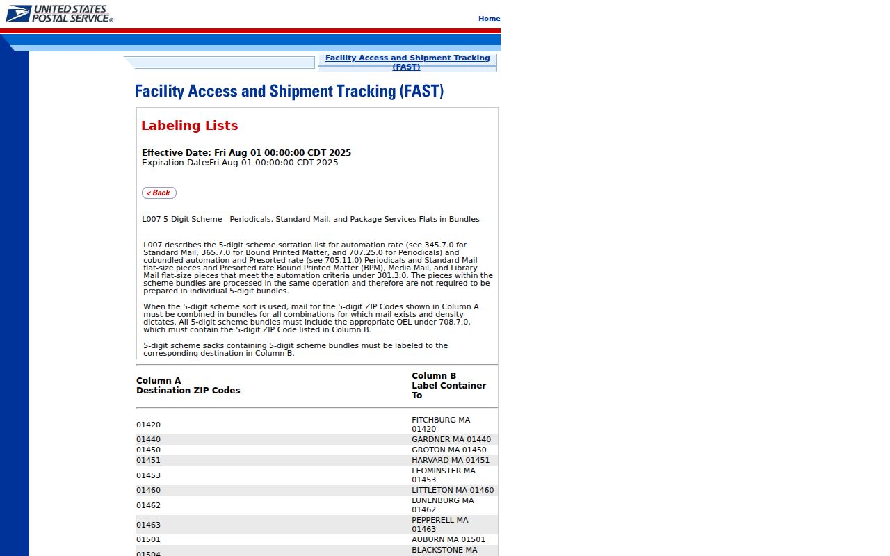
The label-list view provides a dated postal reference; an individual address still needs its own USPS result.
Find Jackson Township Records by ZIP
A ZIP narrows a search area, but the inspected Ocean County tools are not ZIP-wide resident search tools. The Tax Board form accepts municipality, block, lot, qualifier, property class, and property location. The GIS hub supplies parcel, cadastral, easement, right-of-way, imagery, tax-map, zoning, flood, wetlands, streams, subdivision, and site-plan layers. The state voter route was not field-inspectable, and no ZIP-only voter lookup was identified. County voter information is requested through the documented county process, not assumed from a postal code.
- Enter the complete address in USPS ZIP Lookup and save the returned postal city, state, and ZIP with the date checked.
- Use the Ocean County Tax Board search to locate the parcel by municipality and property location, or by block, lot, and qualifier when known.
- Open the Ocean County GIS mapping hub to compare the parcel’s municipal context with the USPS result.
- Record the postal and parcel facts separately. A mismatch is a result to investigate, not a reason to overwrite either system.
Once a ZIP check reaches a specific road or parcel, the Jackson Township street directory provides the separate street-by-street record route. Do not convert a postal result into a general list of people associated with that ZIP.
Jackson Township ZIP Search Fields
The documented fields show why the postal and parcel steps are distinct. USPS is address or city oriented. The county tax form is parcel oriented. Neither inspected form offers a ZIP-only Jackson Township filter. These are the supported inputs, not a claim that either source identifies a current occupant.
| Tool | Field or mode | Input type | What it helps verify |
|---|---|---|---|
| USPS ZIP Lookup | By Address | Complete street, city, and state | Postal city and ZIP returned for one address |
| USPS ZIP Lookup | By City/State | City and state | Postal possibilities, not a municipal boundary decision |
| USPS ZIP Lookup | Cities by ZIP | ZIP | Postal city labels associated with that code |
| Ocean County Tax Board | Municipality; block; lot; qualifier | Selection and text fields | Parcel tax-list key and municipality context |
| Ocean County Tax Board | Property class; property location | Selection and text fields | Property-oriented search, not title proof or a ZIP filter |
The GIS interface was documented as an address, parcel, map, and layer workflow rather than a fixed ZIP form. Its parcel geometry is not a survey. A tax result is also not title proof, so questions needing legal certainty belong with the appropriate custodian or a certified record route.
When an address does not resolve on the first try, compare the street spelling, directional word, unit formatting, postal city, and source date before deciding it is absent. Historical references may use a road or community name that differs from a current parcel label. The official Jackson road map, assessment maps, and county GIS can help align those place names, but none turns a general ZIP search into proof of a postal boundary. Keep the returned source language in the notes.
Jackson Township ZIP Codes and Township Lines
Postal geography and municipal geography serve different systems. USPS routes delivery. County tax records organize parcels. GIS maps geometry and layers. The clerk indexes recorded instruments by legal and party information. An address returned as Jackson, NJ does not prove that every part of the parcel lies within Jackson Township, and a Jackson Township parcel may carry a different postal-city label. A road map is useful for roads, but it is not a ZIP-boundary map.
- ZIP versus ZIP+4
- A ZIP identifies a broad postal delivery area. ZIP+4 adds a smaller delivery segment; neither one is a municipal boundary.
- PO-box ZIP
- A ZIP used for post-office boxes. No Jackson Township PO-box-only code was established in the inspected sources.
- Unique ZIP
- A code assigned to a single institution or organization. No such Jackson Township code was established in the inspected sources.
- Carrier route
- A USPS delivery sequence used for mail distribution. It is not a parcel, township, or resident boundary.
- Situs address
- The physical location tied to a parcel. It can differ from the mailing address shown in tax records.
Jackson Township ZIP Edge Leads
08514, 08533, 08701, 08733, 07728, and 08759 are not confirmed Jackson Township codes in the available official record. They are regional references that may matter only after an exact address is checked. The research did not capture an official USPS or county GIS example that places any of those codes inside the township. It also did not identify an official ZIP boundary intersection for them.
Named places can add confusion. Cassville, Westlake, Four Seasons, Winding Ways, Greenbriar, Gardens at Jackson, Oak Tree, Sixty Acres, Miller Avenue, and Jackson Mills appear in local road, history, or election materials. A community name is a useful map-search term, not a postal designation. Preserve the capitalization and source date, then let USPS answer the delivery label for a particular street.
Note: A regional ZIP reference is only a lead until an official address result and parcel context establish the particular location.
Jackson Township Election Geography Check
Jackson’s official election materials divide the township into 34 polling districts and use named civic locations. That civic geography can help orient a map search when an old address is vague. It does not establish a postal boundary or identify the people connected with a polling site. For ZIP questions, keep an election district, a postal code, and a parcel municipality as separate records.
The Jackson Township elections geography page is shown below. Its locations are useful landmarks for cross-checking a map, while USPS remains the source for postal delivery results.
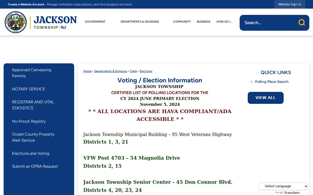
The election view adds local orientation but does not convert a district or named community into a ZIP boundary.
Jackson Township ZIP Code Limits
A postal result does not confirm a person or business at an address. A tax-list owner is not necessarily an occupant, and a deed party is not necessarily a current resident. Those limits matter when combining sources. Use ZIP and parcel data for map, records, family-history, estate, and civic-research questions, then verify the specific record with its custodian.
New Jersey privacy rules can suppress or redact protected information. The Address Confidentiality Program provides a substitute address for eligible participants, and Daniel’s Law governs protected address handling for covered people and immediate family members. OPRA also allows or requires redaction of sensitive identifiers. Respect those limits and do not use postal, parcel, or public-record details to target anyone for unwanted contact.
This Jackson Township ZIP code directory preserves the central research gap: USPS and the county were not shown to offer a complete ZIP-wide resident tool, and only 08527 has a verified label record. An address-specific USPS result, parcel check, and date-stamped source note remain the dependable method.